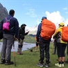
 Max Participants :
15
Max Participants :
15
 Trail Type :

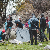
Itinerary Description


Brief Itinerary
Detailed Itinerary
Day 1
Day 1 Make your way to Sankri (1,920M)Day 2
Day 2 Sankri (1,920M) to Barthatra thatch (2,510M) via Jakhol (2,200M)Day 3
Day 3 Barthatra Thatch (2,510M) to Dhaldhar Meadows (3,630M)Day 4
Day 4 Dhaldhar Meadows (3,630M) to Devbasa (3,738M)Day 5
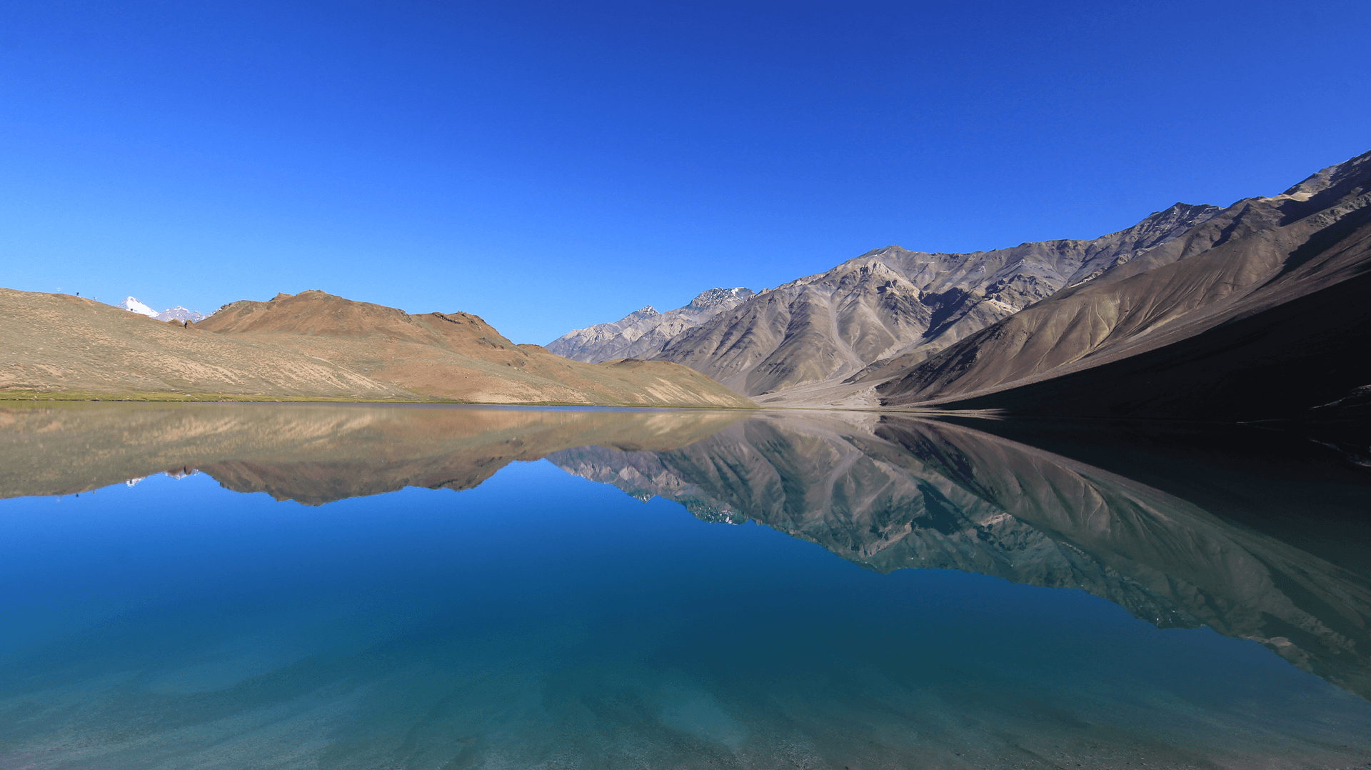
Day 5 Devbasa (3,738M) to Baraadsar Lake (4,600M) via Baraadsar Summit (4,600M) and back to Devbasa (3,738M)Day 6
Day 6 Devbasa (3,738M) to Vasaped (3,070M)Day 7
Day 7 Vasaped (3,070M) to Bhitri (2,360M) via Saru TaalDay 8
Day 8 Bhitri (2,360M) to Dehradun (640M)WHAT'S INCLUDED
- ●Food as per menu on the trek (From lunch on Day 2, till lunch on Day 7)
- ●Forest Permits/Camping Charges, if any (upto the amount charged for Indian nationals)
- ●Tents, sleeping bags, Sleeping mats
- ●Safety Equipment includes static rescue rope, seat harness, carabiners, pulleys
- ●Trek guide, cook, helpers, and porters for carrying common supplies
- ●Mountaineering course certified Trek Leader with Wilderness Emergency Responder & Rescue. course from NIM Uttarkashi
WHAT'S NOT INCLUDED
- ●Meals during road journey & hotel stay.
- ●Portage of personal bags during the trek.
- ●Cost of any kind of Travel Insurance.
- ●Any Expense of personal nature.
- ●Portage of personal backpack.
- ●Any Expense not specified in the inclusions list.
- ●Meals during road journeys.
- ●Transportation from Dehradun to Sankri & back to Dehradun.
Are you eligible for this adventure?
Annapurna Base Camp Trek takes you to a height of 4,130M and is rated a moderate level trek for its long trekking distances. For its elevation and distances, it is recommended for trekkers with some prior experience in the high-altitudes.
Grade
Difficult
Max Altitude
0 mts
Distance
43 km
WIMRS Level Required

Terrain
Prerequisite Skills

Fitness Benchmark
WIMRS Level Required
WIMRS 5
Annapurna Base Camp Trek is a level 4 adventure on the Bikat Rating Scale.
This makes it mandatory for you to have high-altitude experience of preferably multiple treks marked at level 3 on the WIMRS. The altitude, the terrain, and the nature of the climb demand a certain level of endurance and a need for you to be aware of how your body reacts to the various features of the high-altitude environment.
If you do not know what level of WIMRS trek would suit you best, worry not! Fill out this Form:
We will send you a progression chart to help you comfortably get out of your comfort zone in order to level up and ultimately reach your highest potential in the big, bad world of outdoor adventure.
Packing List
This is a list of essential items for individuals doing the trek with Bikat Adventures. This list contains only those items which the participants are required to bring with them. The list excludes those items which are provided by Bikat Adventures on the trek. We have divided the items into five categories. All the items in the list are essential except for those marked as optional.
🟩 Trekking Gear
- Ruck sack bag with rain cover. Qty -1
- . Day Pack Bag - Recommended for treks with summit day
- Head Torch with spare Batteries. Qty -1
- U V protection sunglasses. Qty -1*
- Water Bottles: 2 bottles of 1 liter each*
🟩 Footwear
- Non-skid, deep treaded, high-ankle with water resistant trekking shoes Qty -1
- Pair of light weight Crocks/Sandals Qty -1
🟩 Clothing
- Quick Dry Warm lower or Track Pants. Qty – 2*
- Full sleeves T-shirts/ Sweatshirts. 1 for every 2 days of trekking
- Pair of thick woolen socks. 1 pair for every two days of trekking
- Thermal Body warmer Upper & Lower. Qty-1
- Undergarments. Qty - 1 for every day of trekking
- Warm jacket closed at wrist & neck .Qty-1
- Full sleeves sweater. Qty -1
- Rain wear (Poncho/ Jacket & Pants) . Qty-1
- Pair of waterproof, warm gloves. Qty-1
- Woolen cap. Qty-1
- Sun shielding Hat. Qty -1
🟩 Toiletries
- Personal toiletries kit (Small Towel, Toilet paper, paper soap, Bar soap, toothbrush, toothpaste, cold cream, etc.)
- Sun screen lotion small pack. Qty -1 (Minimum SPF 30)
- Lip Balm small pack. Qty-1
🟩 Miscellaneous
- Camera (Optional)
- Carry your medicines in plenty in case you have any specific ailment. Consult your doctor before joining the trek.
- Dry fruits, Nuts, Chocolate bars (Optional)
Here are a couple of tutorials on What & How to pack your rucksack for your upcoming trek from our experts:
Note-
- *For long trek please carry one spare sunglass
- *In winter trek please try to carry one hot water bottle
- * For long and winter trek to carry warm pent one pair
Frequently Asked Questions
Why Wanderin Man?
(SET- Safety, Expertise & Trust )
Safety
- ●Small Group Size in the ratio of 6:1 (participant to leader)
- ●No compromise on safety and sustainability promise
- ●Experienced and Certified Mountaineering Professional Leaders
- ●Region Mapped with Emergency Evacuation Plan
- ●Certified Standard Equipment by UIAA (International Climbing and Mountaineering Federation certification) & other Similar Bodies
- ●Minimized Risk Management Standard Operating Procedure are applied for every Trek and tour
- ●Certified First Aid Support and Doctors* with constant availability of Safety Equipments like Medical Kit, Rescue Kit
- ●Constant communication is aided with the help of Communication Devices
- ●Certified and registered Transporter for transportation purpose
Expertise
- ●Founders of the company have extensive experience of 15 years having organized 8k+ peak expeditions.
- ●Under the umbrella of Wanderin’ Man Adventures 15+ adventure activities Programs have been organized
- ●Founders have mountaineering certifications from the esteemed mountaineering institutes of India.
- ●Team is composed of experienced mountaineers and trek leaders with thorough understanding of norms and procedures.
Trust
- ●Trust has been the hallmark of our company since its inception be it any program on the list.
- ●Special emphasis is laid on the use of standard procedures and equipments as per the mountaineering norms
- ●95% of our clients have availed our service on repeat basis.
- ●Our business has expanded primarily based on the “word of mouth” from our existing clients to new ones
What Our Customers Say


Cancellation Policy
Cash Refund (All events including Friendship Peak Expedition except other Mountaineering Expeditions) - Cash refunds are only available for bookings made without any discounts, such as promotional codes or dynamic discounts. Additionally, cash refunds are not available for shifted batch bookings or if the booking status is "Booked". The amount of the refund will be determined based on the following guidelines:
Cancellations made up to 45 days before the departure date
Cancellations made up to 31 days before the departure date
Cancellations made between 30 and 21 days before the departure date
Cancellations made between 20 and 11 days before the departure date
Cancellations made less than 11 days before the departure date are not eligible for a cash refund.
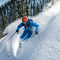
Similar Adventures
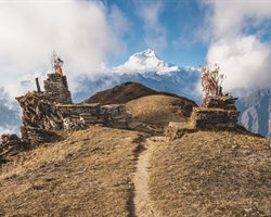
Khopra Ridge Trek
Less popular, less crowded, more beautiful alternative to ABC
- Nepal
- 10 Days
- BRS 4
- 4767 m
Tarsar Marsar Trek
A Shorter and Easier Alternative to the Kashmir Great Lakes Trek
- Kashmir
- 7 Days
- BRS 4
- 4024 m

Hampta Pass Trek
An Enchanting Cross-Over from Manali to Spiti
- Himachal
- 5 Days
- BRS 4
- 4200 m