 Max Participants :
12
Max Participants :
12
 Trail Type :

Itinerary Description
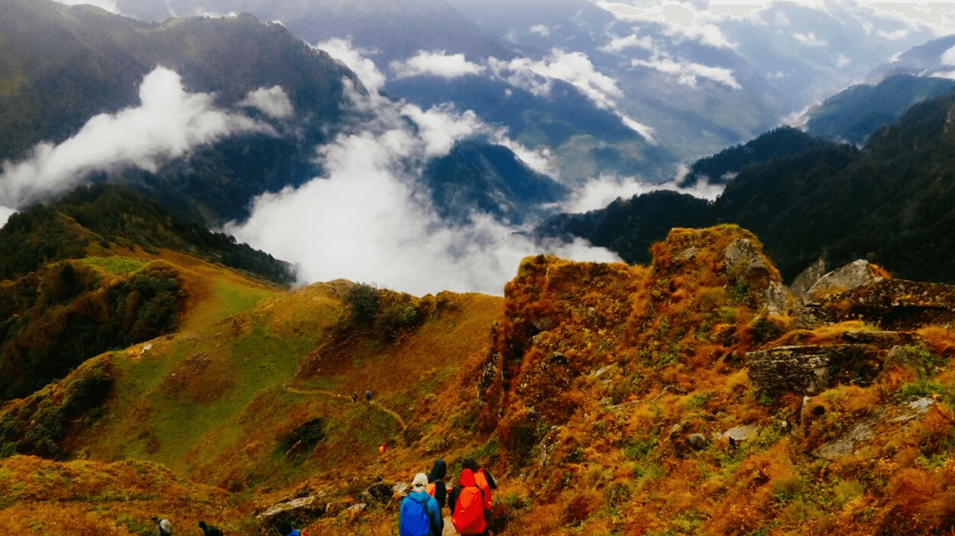
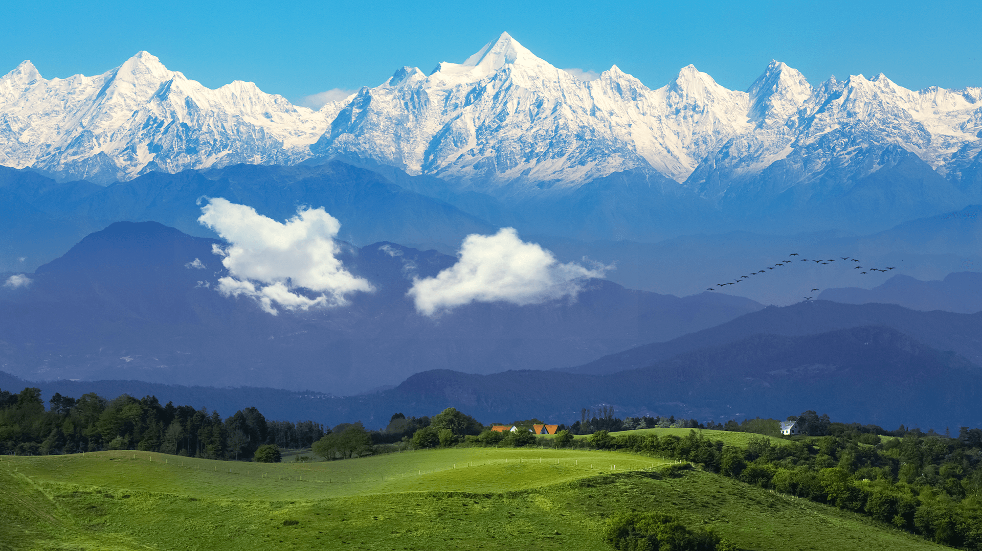
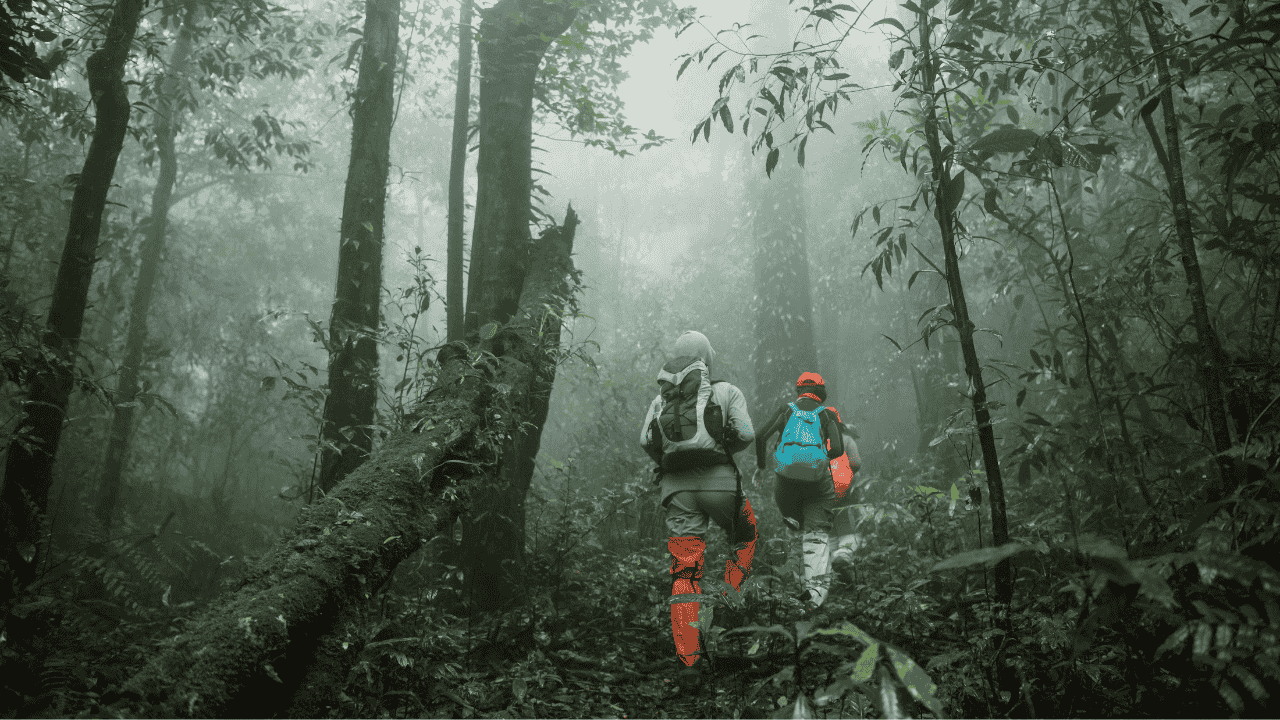
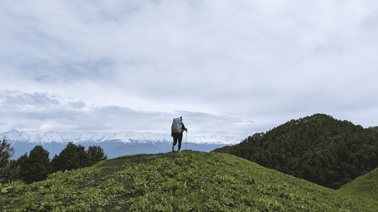
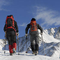
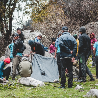
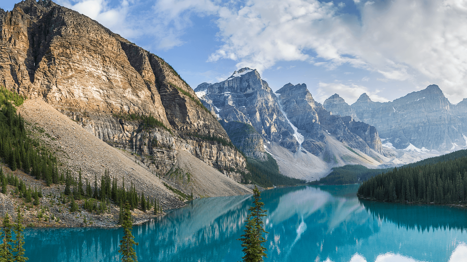
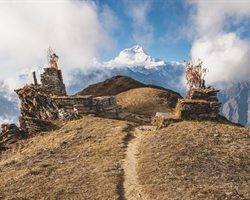
The most challenging journey in the Western Himalayas, considered by many to be more difficult than Kalindi Khal, one of the riskiest treks in India, is Auden's Col. The culmination of a protracted, perilous trip between the pilgrimage towns of Gangotri and Kedarnath is this impossibly high, glaciated pass between the enormous Gangotri and Jogin massifs, which hangs at an astonishing altitude of 5,490M. The journey takes you up in the Garhwal Himalayas in the vast Gangotri glacier region, departing from the high alpine village of Gangotri, which is conceivably one of the greatest trailheads in the country. The powerful Bhagirathi empties loudly and proudly as it descends through huge meadows and lush deodar trees from its glacier source at the foot of Chaukhamba. By no means is the scenery in Auden's Col monotonous. On the first day, you ascend through thick stands of birch and oak trees to reach huge, never-ending meadows with sweeping views of the Gangotri and Jogin peaks. You leave the meadows for the tough, alpine landscape, passing through moraine fields with buried lakes and then climbing the last pass, up the high snow slope. The crevassed Khatling glacier, one of India's most glaciated locations, is reached after ascending the pass. The sacred Vasuki Tal Lake and the snow-covered Mayali Pass are then visited before returning to the moraine and then travelling through thick woods once again. J.B. Auden, a British surveyor, crossed Auden's Col for the first time over this lovely path connecting the Khatling and Rudra valleys in the year 1939. It was another 44 years until the next reported crossing of the col. Even today, Auden's Col is one of the least travelled passes in the nation despite having everything that makes it tough and awesome: the glaciated approach, the lush and lovely lower valleys, the endless moraine, and the breathtaking vistas. On the one hand, the journey is a no-brainer because of its sparse crowds, an ideal mix of breath-taking scenery, and unrivalled views of renowned peaks in the range. However, it is also seen to be a hostile route where the risks experienced outweigh the natural beauty of the surroundings. There are no easy days in this location given the distance travelled and altitude gained each day. The walk is very patience-demanding and is unforgiving on those who struggle to acclimate.


Brief Itinerary
Day 1 Make your way to Gangotri (3,415M)
Day 2 Rest and acclimatization at Gangotri (3,415M)
Gangotri (3,415M) to Nala Camp (3,760M)
Day 4 Nala Camp (3,760M) to Rudugaira Camp (4,350M)
Day 5 Rest and Acclimatization at Rudugaira Base Camp (4,350M)
Day 6 Rudugaira Base Camp (4,350M) to Auden's Col Base Camp (4,720M) via Gangotri Base Camp (4,500M)
Day 7 Auden's Col Base Camp (4,720M) to Khatling Glacier Camp (5,000M) via Auden's Col (5,490M)
Day 8 Khatling Glacier Camp (5,000M) to Zero Point (3,870M)
Day 9 Rest Day at Zero Point (3,870M)
Day 10 Zero Point (3,870M) to Chowki (3,580M)
Day 11 Chowki (3,580M) to Masar Tal (4,135M)
Day 12 Masar Tal (4,135M) to Vasuki Tal (4,135M) via Mayali Pass (5,000M)
Day 13 Vasuki Tal (4,135M) to Kedarnath (3,590M)
Day 14 Kedarnath (3,590M) to Gaurikund (1,985M)
Day 15 Gaurikund (1,985M) to Dehradun (430M)
Day 16 Reserve Day
Detailed Itinerary
Day 1
Day 1 Make your way to Gangotri (3,415M)
The trek begins from Gangotri which is a mountain city on the banks of River Bhagirathi and is known to be the origin of the holy River Ganga. Located in the Greater Himalayan Range, legend says that this is where Goddess Ganga descended when Lord Shiva released the river from the locks of his hair. This holy city which lies at an altitude of 3,415M is a 245 km drive away from Dehradun ? the closest city with an airport. If you have signed up with The Wanderin' Man for a drive from Dehradun to Gangotri, the day starts early. Everyone assembles at the meeting point by 7 in the morning so we can start our long drive up to Gangotri, a holy mountain city in the Uttarkashi district of Uttarakhand. Although there?s nothing more on the agenda for today other than the 8-9 hour drive, it is better to leave as early as possible for two reasons: One, so we can reach as early as possible and give our bodies enough rest for what?s coming the next day. And, two, roads on the mountains are unpredictable and it is always better to account for delays when we start. It is also better to reach before it gets dark.
Day 2
Day 2 Rest and acclimatization at Gangotri (3,415M)
Day two is reserved for rest and for acclimatization to the altitude. This is important to allow your body to adapt to its new environment and reduce chances of adverse health conditions. You can go around and explore the market, delve into the colors and culture of this high-mountain town and visit some places nearby. A little movement around the city would be good for acclimatization. Also, use this time to go through your checklist and do some last-minute shopping for what you might be missing for the trek. While the body acclimatizes, we take this time to get together with the group for a debriefing session where we get to know each other better and delve into the happenings of the next few days - schedule, what to expect, basic do's and don'ts in the mountains, how to maintain the sanctity of the environment and other such matters of importance. We also go for a short acclimatization walk in the evening to adapt to this new environment better.
Day 3
Gangotri (3,415M) to Nala Camp (3,760M)
Distance: 7 km Our first day of trekking in this treacherous terrain involves an altitude climb of close to 350M. The trail for most parts runs through dense forests that occasionally open up to miniature grasslands with unclouded views of limpid skies above. We head southwest from Gangotri, walking down the main valley for around 2 km and then turn east into the Rudugaira valley. The trail from here gradually climbs up through thick oak and birch forests. On crossing the nala, the tree line begins to thin out giving way to wider expanses of landscape in the form of meadows and grazing grounds. Our approach to the campsite for the day offers magnificent views of Gangotri III and Jogin II which looks like a sharks fin when viewed from a certain angle. On reaching the campsite, we rest our weary selves for a bit, get some fuel in the form of hot food and head out for an acclimatization walk early evening.
Day 4
Day 4 Nala Camp (3,760M) to Rudugaira Camp (4,350M)
Distance: 4 km On the agenda today is a 600M altitude gain across a short distance of 4 kms. Needless to say, the ascent up to Rudugaira Base camp will be steep and grueling. Going further ahead from the Nala Camp, the trail climbs to the upper grazing grounds which, if you are lucky, will offer up countless herds of Bharal (Himalayan Mountain Goats) sprinting around these high mountain lands. After crossing a few streams, we begin our climb up a steep spur which will take us straight to Rudugaira Base Camp. We pitch our tents in this beautiful campsite covered in snow and surrounded by famous peaks such as Gangotri I, II, III and Jogin III.
Day 5
Day 5 Rest and Acclimatization at Rudugaira Base Camp (4,350M)
Today is reserved for acclimatization to the altitude since we gained quite a bit of height in the last two days and have also entered a much different terrain. After a late breakfast we go for an acclimatization walk. On climbing just a few hundred meters from the campsite, we get our first view of Auden's Col which is inspiring to say the least. We end the day early so as to get optimum rest.
Day 6
Day 6 Rudugaira Base Camp (4,350M) to Auden's Col Base Camp (4,720M) via Gangotri Base Camp (4,500M)
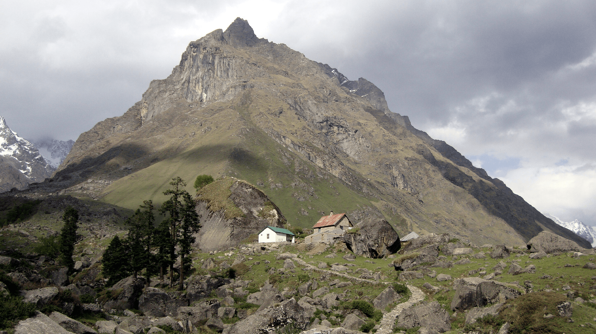
Distance: 8 km Today we start early and continue on towards Gangotri base camp which is approximately 4 kms from our campsite. A short while into our trek, we get our first glimpse of Auden?s Col. The view is absolutely spectacular. Covered in white, the col appears benign as it straddles a precarious ridge from the mighty Jogin I on the east and an equally formidable ridge running from the Gangotri III peak on the North West.
Day 7
Day 7 Auden's Col Base Camp (4,720M) to Khatling Glacier Camp (5,000M) via Auden's Col (5,490M)
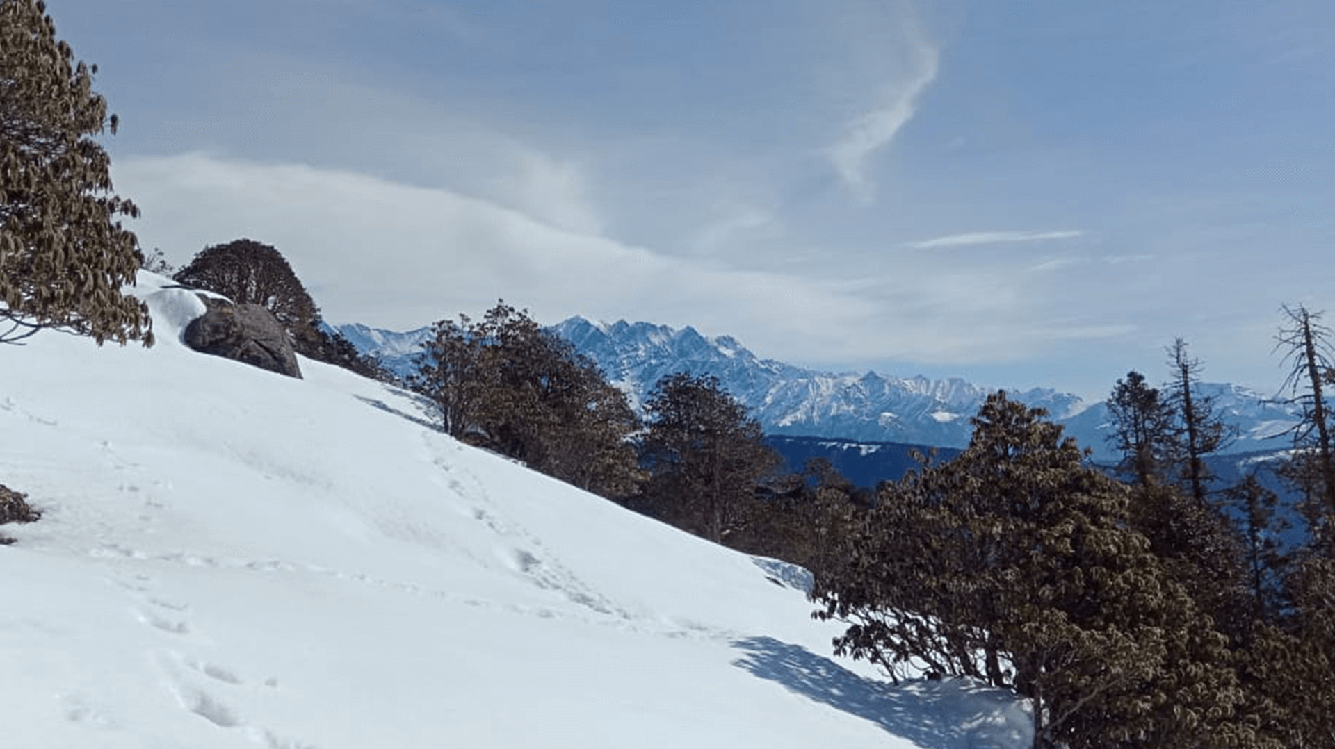
Distance: 5 km Today is THE day. We will be crossing the formidable yet spectacular Auden?s Col which lies at the confluence of four huge massifs: Jogin I and Gangotri III flanking us on either side with the Jogin glacier behind us and Khatling lying in front of us. Expect this to be a tiring day. We continue on the moraine-ridden terrain until we reach the glacier. After a short while on the glacier, we hit a patch of ascent with a gradient between 30-50 degrees which will need to be navigated with caution. We rope up for this steep patch, which spans close to 1.5 kms, for utmost safety. The climb up to the col should take close to 3 hours. However, the climb up is not the main challenge for today. The descent from the col is tricky and requires navigating a steep and narrow gully inclined at an angle of 70-75 degrees. Once this gully is crossed, however, the glacier flattens out ? the broadened valley giving way to views of massive icefalls, glaciers and formidable peaks in the region. A short walk down the glacier brings us to our camp for the night.
Day 8
Day 8 Khatling Glacier Camp (5,000M) to Zero Point (3,870M)
Distance: 10 km We have successfully crossed the pass and are now on the other side, but the challenge has only just begun. Today is going to be one of the longest days of the expedition and also the most demanding. We will be crossing the forbidding Khatling glacier today, which is almost 10 kms long and extremely challenging to navigate. As one of the most heavily glaciated regions in India, the Khatling glacier is a moraine-rich land full of hidden, open and deep crevasses for all the 10 kms. This unmarked route over loose gravel and scree with sections of steep ascents and descents demands extreme caution with each step forward. Towards the end, we are reunited with a marked trail which leads us to our campsite for the day by the snout of the Khatling glacier.
Day 9
Day 9 Rest Day at Zero Point (3,870M)
Since the last couple of days have been extremely taxing, we rest at Zero Point today.
Day 10
Day 10 Zero Point (3,870M) to Chowki (3,580M)
Distance: 7 km Today we will be leaving the land of snow and making own way to the warmer reaches of the valley. After 3 kms of continuing our walk along the river, we reach the meadows. Chowki, our grassy campsite after spending days in rocks and snow, is a 4 km walk from here.
Day 11
Day 11 Chowki (3,580M) to Masar Tal (4,135M)
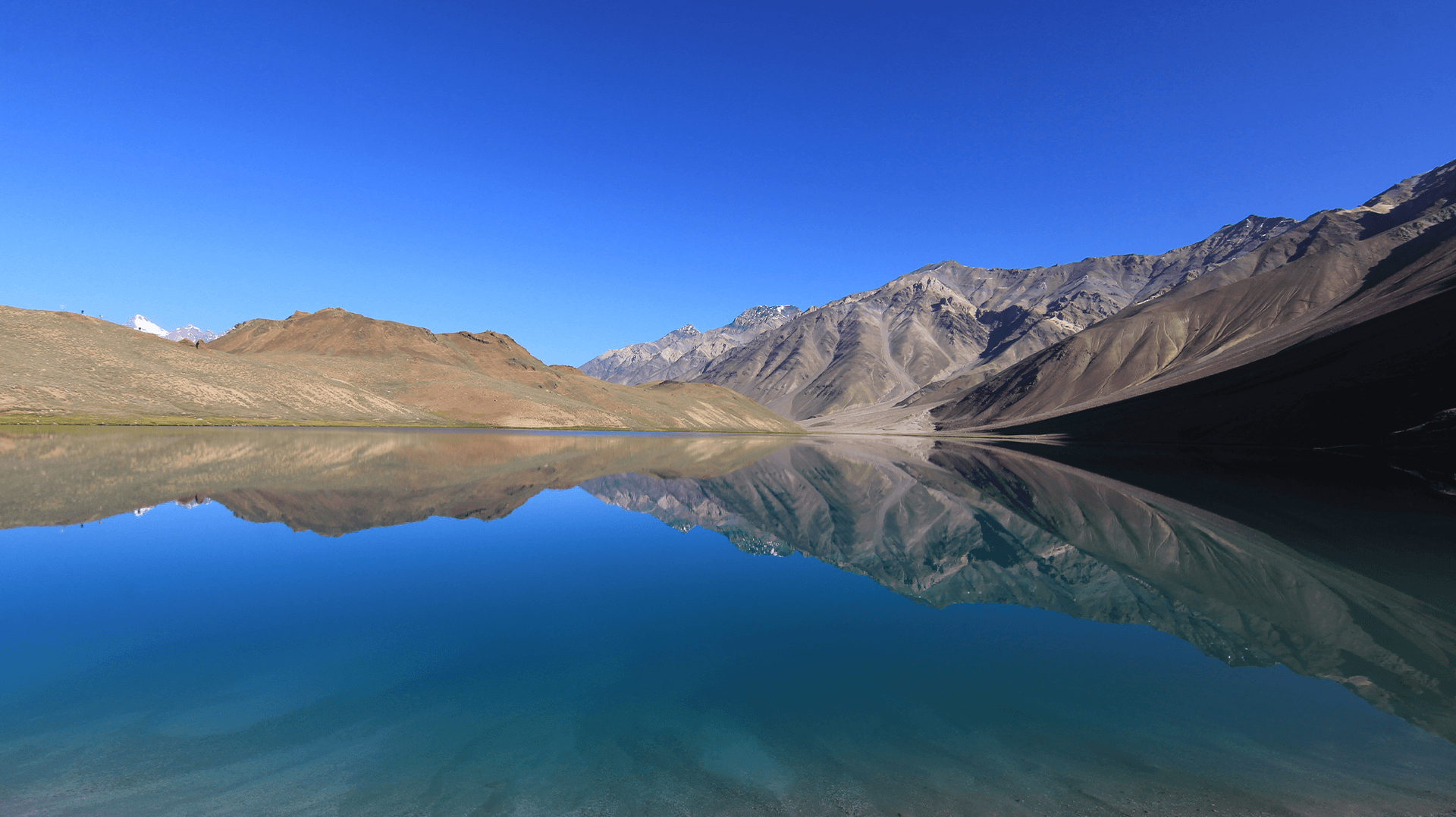
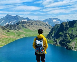
Distance: 8 km We will be making our way to one of the most isolated lakes in the Garhwal region, Masar Tal, today. Stationed at an altitude of 4,135M, this pristine, high-altitude lake rests to the east of the snowy Khatling glacier. The route starts off as a steep ascent with a view of Thalay Sagar- a gorgeous peak of 6,904M that lie 10 kms southwest of the holy site of Gaumukh. After the initial ascent, we cross a ridge over the valley which takes us straight to Masar Tal. We camp by this scenic lake.
Day 12
Day 12 Masar Tal (4,135M) to Vasuki Tal (4,135M) via Mayali Pass (5,000M)
Distance: 12 km Onwards to another glacial lake today, Vasuki Tal is at an altitude of 4,135M. Today?s trail begins with a steep ascent over boulders on a ridge to Masar Top. The path, then, descends slightly before climbing up the glacier to reach the top of Mayali Pass ? another hidden gem of Uttarakhand. The descent from here is as precarious as the one we left behind when we climbed down from Khatling glacier. This section will require the use of fixed ropes on which we will rappel down. We continue our descent down all the way to Vasuki Tal which is our campsite for the day.
Day 13
Day 13 Vasuki Tal (4,135M) to Kedarnath (3,590M)
Distance: 7 km We will finally be making our way to Kedarnath today ? which happens to be one of the holiest shrines to Shiva. As one of the twelve Jyotirlings, Kedarnath sees a lot of pilgrims in the months when the area is not buried under snow. Kedarnath is a 7 km trek from Vasuki Tal which takes about 3-4 hours to cover. We visit the temple in the evening and spend our night in a warm bed in a hotel, after days on cold, uneven surfaces.
Day 14
Day 14 Kedarnath (3,590M) to Gaurikund (1,985M)
Distance: 14 km We trek down this easy, well-marked trail of 14 kms which takes us directly to Gaurikund. We will be spending our night in a guesthouse/hotel.
Day 15
Day 15 Gaurikund (1,985M) to Dehradun (430M)
Distance: 252 km Drive The drive back down to Dehradun is alongside the fierce Ganga River. It should take close to 9 hours to reach. Expect to get to Dehradun by late evening.
Day 16
Day 16 Reserve Day
In case of bad weather or other difficulties which might set us off schedule during the course of the entire expedition, Day 16 is set as a reserve day. This will only get used if unexpected and unforeseeable conditions present themselves at the last minute preventing us from reaching our destination as planned.
WHAT'S INCLUDED
WHAT'S NOT INCLUDED
Are you eligible for this adventure?
Annapurna Base Camp Trek takes you to a height of 4,130M and is rated a moderate level trek for its long trekking distances. For its elevation and distances, it is recommended for trekkers with some prior experience in the high-altitudes.
Grade
Difficult
Max Altitude
5490 mts
Distance
75 km

WIMRS Level Required

Terrain
Prerequisite Skills

Fitness Benchmark
WIMRS Level Required
WIMRS 6
Annapurna Base Camp Trek is a level 4 adventure on the Bikat Rating Scale.
This makes it mandatory for you to have high-altitude experience of preferably multiple treks marked at level 3 on the WIMRS. The altitude, the terrain, and the nature of the climb demand a certain level of endurance and a need for you to be aware of how your body reacts to the various features of the high-altitude environment.
If you do not know what level of WIMRS trek would suit you best, worry not! Fill out this Form:
We will send you a progression chart to help you comfortably get out of your comfort zone in order to level up and ultimately reach your highest potential in the big, bad world of outdoor adventure.
Packing List
This is a list of essential items for individuals doing the trek with Bikat Adventures. This list contains only those items which the participants are required to bring with them. The list excludes those items which are provided by Bikat Adventures on the trek. We have divided the items into five categories. All the items in the list are essential except for those marked as optional.
🟩 Trekking Gear
- Ruck sack bag with rain cover. Qty -1
- . Day Pack Bag - Recommended for treks with summit day
- Head Torch with spare Batteries. Qty -1
- U V protection sunglasses. Qty -1*
- Water Bottles: 2 bottles of 1 liter each*
🟩 Footwear
- Non-skid, deep treaded, high-ankle with water resistant trekking shoes Qty -1
- Pair of light weight Crocks/Sandals Qty -1
🟩 Clothing
- Quick Dry Warm lower or Track Pants. Qty – 2*
- Full sleeves T-shirts/ Sweatshirts. 1 for every 2 days of trekking
- Pair of thick woolen socks. 1 pair for every two days of trekking
- Thermal Body warmer Upper & Lower. Qty-1
- Undergarments. Qty - 1 for every day of trekking
- Warm jacket closed at wrist & neck .Qty-1
- Full sleeves sweater. Qty -1
- Rain wear (Poncho/ Jacket & Pants) . Qty-1
- Pair of waterproof, warm gloves. Qty-1
- Woolen cap. Qty-1
- Sun shielding Hat. Qty -1
🟩 Toiletries
- Personal toiletries kit (Small Towel, Toilet paper, paper soap, Bar soap, toothbrush, toothpaste, cold cream, etc.)
- Sun screen lotion small pack. Qty -1 (Minimum SPF 30)
- Lip Balm small pack. Qty-1
🟩 Miscellaneous
- Camera (Optional)
- Carry your medicines in plenty in case you have any specific ailment. Consult your doctor before joining the trek.
- Dry fruits, Nuts, Chocolate bars (Optional)
Here are a couple of tutorials on What & How to pack your rucksack for your upcoming trek from our experts:
Note-
- *For long trek please carry one spare sunglass
- *In winter trek please try to carry one hot water bottle
- * For long and winter trek to carry warm pent one pair
Frequently Asked Questions
Why Wanderin Man?
(SET- Safety, Expertise & Trust )
Safety
- ●Small Group Size in the ratio of 6:1 (participant to leader)
- ●No compromise on safety and sustainability promise
- ●Experienced and Certified Mountaineering Professional Leaders
- ●Region Mapped with Emergency Evacuation Plan
- ●Certified Standard Equipment by UIAA (International Climbing and Mountaineering Federation certification) & other Similar Bodies
- ●Minimized Risk Management Standard Operating Procedure are applied for every Trek and tour
- ●Certified First Aid Support and Doctors* with constant availability of Safety Equipments like Medical Kit, Rescue Kit
- ●Constant communication is aided with the help of Communication Devices
- ●Certified and registered Transporter for transportation purpose
Expertise
- ●Founders of the company have extensive experience of 15 years having organized 8k+ peak expeditions.
- ●Under the umbrella of Wanderin’ Man Adventures 15+ adventure activities Programs have been organized
- ●Founders have mountaineering certifications from the esteemed mountaineering institutes of India.
- ●Team is composed of experienced mountaineers and trek leaders with thorough understanding of norms and procedures.
Trust
- ●Trust has been the hallmark of our company since its inception be it any program on the list.
- ●Special emphasis is laid on the use of standard procedures and equipments as per the mountaineering norms
- ●95% of our clients have availed our service on repeat basis.
- ●Our business has expanded primarily based on the “word of mouth” from our existing clients to new ones
What Our Customers Say


Cancellation Policy
Cash Refund (All events including Friendship Peak Expedition except other Mountaineering Expeditions) - Cash refunds are only available for bookings made without any discounts, such as promotional codes or dynamic discounts. Additionally, cash refunds are not available for shifted batch bookings or if the booking status is "Booked". The amount of the refund will be determined based on the following guidelines:
Cancellations made up to 45 days before the departure date
Cancellations made up to 31 days before the departure date
Cancellations made between 30 and 21 days before the departure date
Cancellations made between 20 and 11 days before the departure date
Cancellations made less than 11 days before the departure date are not eligible for a cash refund.
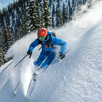
Similar Adventures
Khopra Ridge Trek
Less popular, less crowded, more beautiful alternative to ABC
- Nepal
- 10 Days
- BRS 4
- 4767 m
Tarsar Marsar Trek
A Shorter and Easier Alternative to the Kashmir Great Lakes Trek
- Kashmir
- 7 Days
- BRS 4
- 4024 m

Hampta Pass Trek
An Enchanting Cross-Over from Manali to Spiti
- Himachal
- 5 Days
- BRS 4
- 4200 m